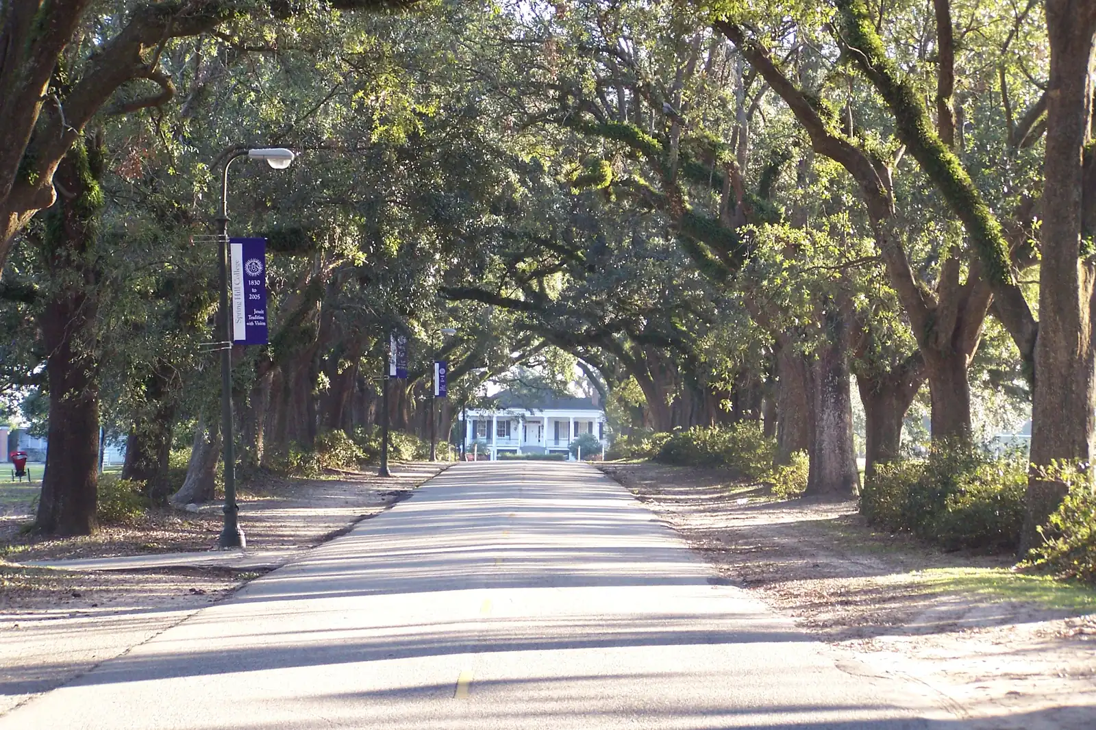
Mobile's 11 mapped areas, from downtown and Midtown to Dog River and the 2023 west Mobile annexations, with ZIP codes, high schools and home values.
Last checked Oct. 17, 2026. Sources: the City of Mobile’s open data (city limits, address points, historic districts, neighborhood overlays, annexations and the Map for Mobile development framework), the Map for Mobile plan, the Toulminville Neighborhood Plan and the city’s annexation page; the Mobile County Public Schools school zone lookup; the Alabama State Department of Education’s 2024-25 report card; Zillow Research; the Census Bureau; and OpenStreetMap.
Mobile is a city of 203,416 people, according to the Census Bureau’s 2020-2024 American Community Survey five-year estimates. The old city sits on the Mobile River, with downtown, Midtown and the historic districts around it. Interstate 10 crosses the south side and runs under the river toward Baldwin County, Interstate 65 runs north from I-10 in west Mobile, and Airport Boulevard, Government Boulevard, Old Shell Road and Spring Hill Avenue run west from the center. In July 2023, voters in three areas of west Mobile chose to join the city, which added more than 19,000 residents, according to the city’s annexation page.
The city’s address data held 117,554 address points inside city limits on Oct. 17, 2026. Three things to know before you look at a listing:
- The mailing city is not always the city. 1,662 addresses inside Mobile carry a Theodore mailing address, and a few carry Semmes or Eight Mile. The other way around, the city’s own address data has more than 18,000 addresses with a Mobile mailing city outside city limits. The city’s My Place tool shows whether a property is inside city limits.
- School zones do not follow the city line. Mobile County Public Schools serves the city and most of the county, and its zones cross city limits: Africatown, inside Mobile, is zoned mostly for Vigor High and Whitley Elementary in Prichard. Saraland, Satsuma and Chickasaw run their own systems. Check any address with the district’s school search.
- ZIP codes are big. City addresses use 24 ZIP codes; the five with the most are 36608, 36695, 36605, 36609 and 36606. One ZIP code often covers several neighborhoods with very different home values.
The areas at a glance
Home values are the Zillow Home Value Index for September 2026: a modeled typical value for the middle third of homes in the whole ZIP code, not a sale price. The citywide figure was $196,696. High school shares come from a sample of 160 address points in each area run through the district’s zone lookup; scores are from the state’s 2024-25 report card.
| Area | Main ZIP code | Zoned high school (2024-25 score) | Typical value, main ZIP |
|---|---|---|---|
| Downtown | 36602 | Ben C. Rain (75) for 88%, Murphy (72) | $328,784 |
| Oakleigh Garden District | 36604 | Murphy (72) | $199,625 |
| Midtown | 36604 | Murphy (72) | $199,625 |
| Maysville and Oakdale | 36605 | Lillie B. Williamson (67) for 92%, Rain (75) | $91,428 |
| Spring Hill | 36608 | Murphy (72) | $241,219 |
| Crichton | 36607 | John L. LeFlore (67) | $117,691 |
| Toulminville | 36617 | John L. LeFlore (67) | $60,444 |
| Africatown | 36610 | C.F. Vigor (68) | $36,360 |
| Dog River and the Peninsula | 36605 | Ben C. Rain (75) | $91,428 |
| Cottage Hill corridor | 36695 | Baker (79) for 79%, W.P. Davidson (74) | $279,459 |
| Kings Branch and Orchard Estates | 36618 | Mary G. Montgomery (80) in Kings Branch; split in Orchard Estates | $170,047 |
Map of the areas
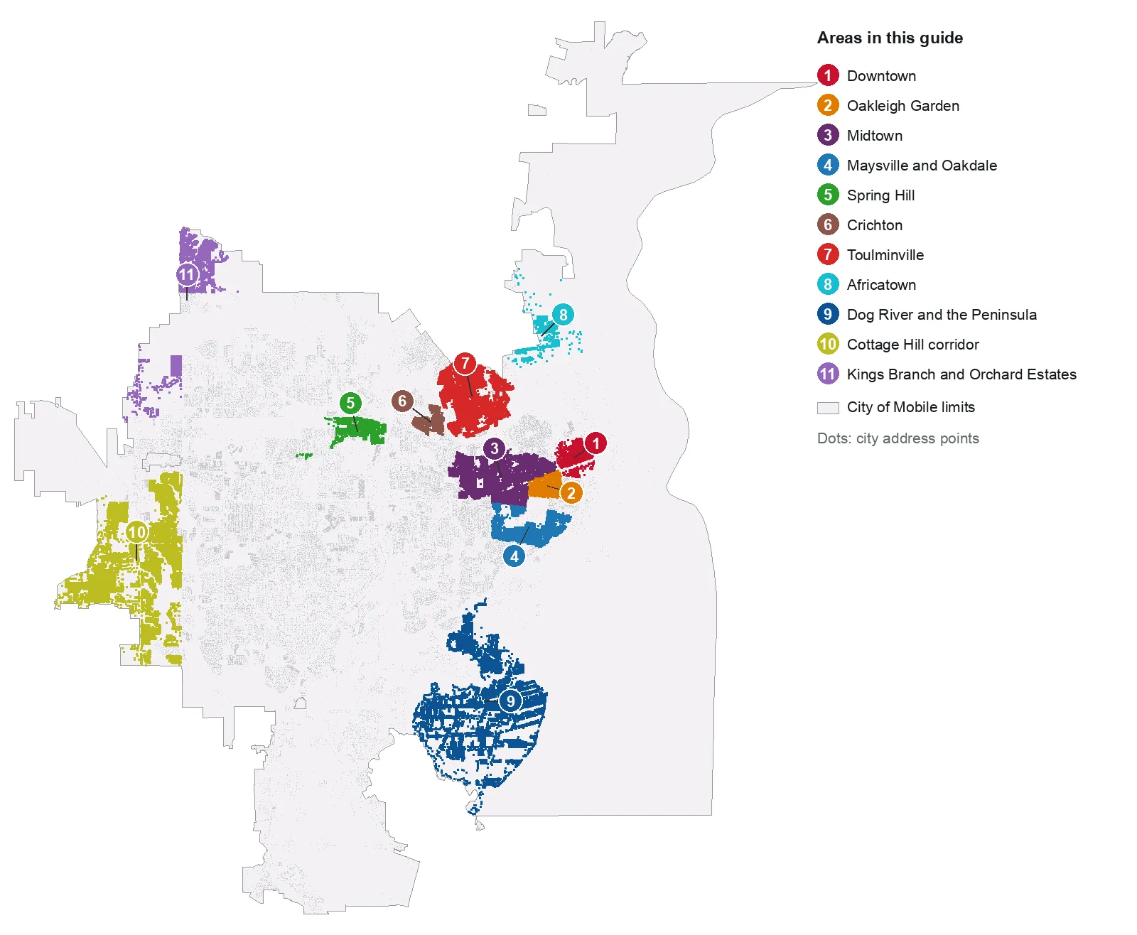
Map: Azalea City Today from the City of Mobile’s city limits and address points and the area boundaries described below, Oct. 17, 2026. Each dot is an address point; gray dots are addresses outside the 11 areas.
The areas
Downtown. The Downtown area of the city’s Map for Mobile framework: Dauphin Street, the squares and the De Tonti Square, Church Street East and Lower Dauphin historic districts, and the GM&O Transit Center, hub of seven bus routes.
Oakleigh Garden District. The locally designated historic district south of Government Street, named for the Oakleigh house museum, with Washington Square. All zoned for Murphy High.
Midtown. Four historic districts west of downtown, Old Dauphin Way, Leinkauf, Ashland Place and Midtown, with Lyons Park, Memorial Park and Murphy High.
Maysville and Oakdale. Two National Register districts south of Midtown, with Harmon-Thomas Park, Taylor Park and Lillie B. Williamson High.
Spring Hill. The residential area beside Spring Hill College between Old Shell Road and Spring Hill Avenue, with the city’s Springhill Traditional Center District. Zoned for Austin Elementary and Murphy High.
Crichton. A compact neighborhood north of Spring Hill Avenue and east of I-65, with Mill Street Park and Route F buses on Mobile Street.
Toulminville. North of Three Mile Creek, with its own city neighborhood plan adopted in 2023, LeFlore High, Washington Middle and the Toulminville Branch Library.
Africatown. The historic community by the Mobile River, mapped by the city as a zoning overlay, with a 2016 neighborhood plan and a planned welcome center.
Dog River and the Peninsula. The city’s Peninsula overlay between Dog River and Mobile Bay off Dauphin Island Parkway, with Rain High, Pillans Middle and Gilliard Elementary inside it.
Cottage Hill corridor. The largest of the 2023 annexations, along Schillinger Road South, Cottage Hill Road and Dawes Road, about 3 miles from Mobile Regional Airport.
Kings Branch and Orchard Estates. The two smaller 2023 annexations in west Mobile, off Moffett Road, Zeigler Boulevard and Schillinger Road North.
Comparing Mobile with its neighbors
Property tax rates, schools, home values, commutes and city services for Mobile, Chickasaw, Prichard and Semmes side by side: Mobile vs Chickasaw vs Prichard vs Semmes. For the citywide market, see our home prices guide; for report cards, calendars and magnet schools, our schools guide. Getting set up: moving here, property taxes, parks and trails and getting around.
How we built this
We named only areas a public source places on a map, and we used the source’s own boundary:
- City plans and maps. The Downtown area of the city’s Map for Mobile development framework; the city’s locally designated and National Register historic districts (Oakleigh Garden, Old Dauphin Way, Leinkauf, Ashland Place, Midtown, Maysville and Oakdale); its Africatown, Peninsula and Springhill neighborhood overlay districts; and the Cottage Hill, Kings Branch and Orchard Estates polygons on its annexations map, all from the city’s open data site.
- The Toulminville Neighborhood Plan, adopted in 2023, which describes Toulminville’s boundary.
- OpenStreetMap, which maps and names Spring Hill, Crichton and Toulminville as residential areas, used for those boundaries.
The 11 areas hold 34,245 of the city’s 117,554 address points, about 29%. Much of central and west Mobile, around Airport Boulevard, Cottage Hill Road east of the annexation, Hillcrest Road and the University of South Alabama, has no neighborhood boundary in the city’s map layers, so it is not split into areas here; OpenStreetMap names many subdivisions there, and we do not write about individual subdivisions. The city does not publish a homeowners association registry. Area edges are approximate; the district’s school search and the Mobile County Revenue Commission records are the authority for any one address. Place and store data are © OpenStreetMap contributors.
Frequently asked questions
What are the neighborhoods in Mobile, Alabama?
Our guide covers 11 areas that a city plan, a city map or OpenStreetMap places on a map: Downtown, the Oakleigh Garden District, Midtown, Maysville and Oakdale, Spring Hill, Crichton, Toulminville, Africatown, Dog River and the Peninsula, the Cottage Hill corridor, and Kings Branch and Orchard Estates.
What ZIP codes are in Mobile?
City address points inside Mobile city limits use 24 ZIP codes. The five with the most are 36608, 36695, 36605, 36609 and 36606, according to the city’s address data on Oct. 17, 2026.
Do Mobile school zones follow city limits?
No. Mobile County Public Schools serves the city and most of the county, and its zones cross the city line. Africatown, inside Mobile, is zoned mostly for Vigor High and Whitley Elementary, both in Prichard. Saraland, Satsuma and Chickasaw run their own school systems.
Which high schools serve Mobile neighborhoods?
In the 11 areas in this guide: Murphy, Ben C. Rain, Lillie B. Williamson, John L. LeFlore, C.F. Vigor, Baker, W.P. Davidson, Mary G. Montgomery and Mattie T. Blount, according to the Mobile County Public Schools zone lookup. Their 2024-25 state report card scores ranged from 67 to 80.
What is the typical home value in Mobile?
$196,696 in September 2026, according to the Zillow Home Value Index, down 0.4% from a year earlier. In the main ZIP codes of the areas in this guide it ranged from $36,360 in 36610 to $328,784 in 36602.
Have your say